11.1 Exeter is a relatively small City with strong rural connections and a long established character. Out of a total area of 4,718 hectares, approximately half is outside the built-up area. As the City has grown the establishment of the Valley Parks and protection of the countryside on the urban fringe, through the Local Plan, has effectively integrated the rural setting with the urban area. The hills to the north and west of the City, particularly the ridgelines, give Exeter a distinctive character. The green wedges which separate Topsham and Pinhoe from the main urban area, which separate the east and west of the City along the riverside and which separate areas within the City, help to define the uniqueness of each part of the City.
11.2 The importance of ecological considerations in the environment is widely recognised. Ecology is concerned with the relationship between the activities of plant and animal life and the interests of man. As the City expands, the natural habitats of the City must be protected.
11.3 The Government's objectives in rural areas (Planning Policy Statement 7 : Sustainable Development in Rural Areas) are to raise the quality of life; and the environment; promote more sustainable patterns of development; develop competitive, diverse and thriving rural enterprise; and promote sustainable, diverse and adaptable agricultural sectors. Building in the open countryside, away from existing settlements or from areas allocated for development in the Local Plan, should be strictly controlled. Regional Planning Guidance also points to the relationship between the region's environment and its economic health. The Guidance emphasises the need to safeguard and enhance the quality and diversity of the natural environment. The Structure Plan advises that the quality of Devon's landscape and its distinctive local characteristics, together with the biodiversity and earth science resource of the County's natural environment, should be maintained and enhanced.
11.4 The Council has carried out a landscape appraisal of all open countryside in and around the City. Based on this appraisal, open land is identified which is to be protected from development because of its intrinsic merit and its contribution to the distinctive landscape setting of the City.
11.5 The continuous nature and sheer size of hills to the north are of major landscape significance, providing the largest and most important part of the landscape setting and containment of the City, which is so essential to its character. The hills extend for 5 kilometres east to west and represent about one eighth of the City Council area outside the urban limit. Although physically separated, this area continues west of the River Exe Valley to include the hills to the north and west of Exwick. Together with the lower lying land of the adjoining valleys of the River Exe, Culm and Clyst, the landscape also forms an integral part of the wider rural scene. By containing the urban area, the hills, which are themselves intrinsically attractive, preserve the pastoral landscape of a large part of East Devon. The links with the Valley Parks (see 7.7-7.22) enhance their value by bringing the countryside well into the built- up area of the City.
11.6 Between the motorway and Hill Barton Road is attractive open farm land, rolling north and south of a central ridgeline, which provides visual links to the hills and open countryside beyond the City to the north and east and serves to maintain the separate identity and setting of Monkerton, Pinhoe and Hill Barton.
11.7 On the opposite side of the City the land between Cleve House and Whitestone Cross is similarly dominated by a ridgeline that is an integral part of the hilly countryside to the west of Exeter and which forms an attractive rural boundary to the densely developed residential areas.
11.8 The open flattish, agricultural and horticultural land comprising large fields and low hedges between Countess Wear and Topsham, might be considered of less obvious interest but it is of significant local importance in clearly separating the settlements of Exeter and Topsham and maintaining their distinct identities. The attractive rural landscape of small fields, hedgerows and copses to the north and east of Topsham provides the essential green setting to the historic settlement of Topsham. Both these areas contribute to, and are an integral part of, the wider rural landscape of East Devon and ensure the south eastern containment of the City.
11.9 Open land to the south and south-east of Alphington and the southern part of Matford Marshes comprise three inter-related areas of distinct character. The flat, open, low-lying, arable and pasture land of Matford Marshes provides a visual link between the wider flood plain to the south-east and the Matford Brook Valley. By contrast, the adjoining Knowle Hill, with its steeply wooded and arable slopes, is a major landscape feature marking the southern approach to the City. Just beyond Knowle Hill, the land that defines the southern boundary of Alphington is modern arable farmland which rises up to the Markham Lane ridge, enhancing the setting of Alphington and of the City.
11.10 Complementing these areas, and forming an important part of Exeter's landscape setting, are the seven Valley Parks and Stoke Woods (see 7.7 – 7.23).
11.11 The appraisal above demonstrates that the open land around Exeter performs a variety of roles including the separation of settlements, maintaining distinct identities and enabling informal recreation. It contains high quality agricultural land and land of nature conservation importance. Overall, it contains land of intrinsic landscape merit which provides the setting for the City as a whole and for local areas. It is the combination of these roles and qualities and their relationship with, and importance to, the population of the adjoining urban area which establishes the unique nature of this land compared to the wider countryside and merits its protection from inappropriate development.
11.12 Development in these areas will not be permitted unless it maintains local distinctiveness and character. Local distinctiveness is that which sets a locality apart from anywhere else. Acceptable uses will be concerned with agriculture or forestry, the change of use, conversion or appropriate extension of buildings or the provision of infrastructure. The Council wishes to encourage rural enterprise and will allow for the re-use or adaptation of agricultural, horticultural and other rural buildings for new uses, providing their form, bulk and general design are in keeping with their surroundings and the landscape quality of the area is protected. Active outdoor recreation will also be permitted, subject to certain safeguards (see 11.14).
11.13 Park and ride plays a very important part in the Council's transportation strategy and can have a significant impact on reducing the environmental effects of road traffic. Whilst park and ride sites should not normally be sited on greenfield and should, ideally, be provided as part of other development proposals, they need to be located on or close to the major radial routes. The need to complete a ring of park and ride sites around the City may, therefore, require greenfield to be considered. The loss of such land must be balanced against the environmental advantages of the park and ride strategy. Its release would be treated as an exception which would not represent a precedent for the development of other land nearby.
11.14 Proposals for active outdoor recreation will be dependant on establishing that harm would not be caused to the character or amenity of the area, particularly by the nature, scale, extent, frequency or timing of the recreational activity, including the impact of noise. For example, keeping horses as stock is a normal rural land use but developing an area for outdoor recreation where the horses may be used, such as a dressage ring, riding school or facilities for regular events, may impact on the landscape through the provision of car parks, public toilets or information centres. The extent and visual impact of landforming works, including the formation of playing surfaces, terraces or mounding and the planting of trees, needs to be planned with care. Built development should only be included if it is necessary to facilitate the proposal such as a changing room associated with a playing field, and is designed to maintain local distinctiveness and character although the benefit of the recreational activity will be weighed against the harm to the character and amenity of the area. If the principle of the proposal is acceptable the impact of traffic in the landscape should be reduced by ensuring that the development is accessible by a choice of means of transport.
11.15 Policy LS1 complements Structure Plan policy C014, which states that the use of the best and most versatile agricultural land for any form of development not associated with agriculture or forestry should only be permitted where there is an over-riding need for development in that location which outweighs the need to protect such land.
11.16 The safeguarding of mineral deposits is achieved through the identification of Mineral Consultation Areas in the Minerals Local Plan prepared by the County Council. This provides for the City Council to consult simultaneously with the County Council and the minerals industry when planning applications are received for non-mineral development in the area. The Consultation Areas at Pinhoe and Bishops Court are identified on the Proposals Map to indicate that the Council will apply Structure Plan policy MN1 which aims to safeguard mineral deposits from unnecessary sterilisation by surface development.
11.17 At Pinhoe the County Council have made it clear that the area identified beyond the land with planning permission for mineral working is regarded as a buffer zone and it is unlikely that further planning permission for mineral working would be granted. Since the City Council would oppose all forms of development in the buffer zone it is identified within the Green Area. The land with planning permission at Pinhoe and the rock face adjacent to the Quarry entrance at Bishops Court are both designated as Regionally Important Geological Sites (see 11.30).
LS1: DEVELOPMENT WHICH WOULD HARM THE LANDSCAPE SETTING OF THE CITY WILL NOT BE PERMITTED. PROPOSALS SHOULD MAINTAIN LOCAL DISTINCTIVENESS AND CHARACTER AND:
(a) BE REASONABLY NECESSARY FOR THE PURPOSES OF AGRICULTURE, FORESTRY, THE RURAL ECONOMY, OUTDOOR RECREATION OR THE PROVISION OF INFRASTRUCTURE; OR
(b) BE CONCERNED WITH CHANGE OF USE, CONVERSION OR EXTENSION OF EXISTING BUILDINGS:
ANY BUILT DEVELOPMENT ASSOCIATED WITH OUTDOOR RECREATION MUST BE ESSENTIAL TO THE VIABILITY OF THE PROPOSAL UNLESS THE RECREATIONAL ACTIVITY PROVIDES SUFFICIENT BENEFIT TO OUTWEIGH ANY HARM TO THE CHARACTER AND AMENITY OF THE AREA.
11.18 Exeter contains a rich variety of wildlife habitats. This appears to be due to a fortunate combination of geology/topography and geography combined with enlightened protection and enhancement. Exeter is built around a series of valleys. This has meant that the valley sides and ridgelines have often, due to their steepness, remained undeveloped, while the valley flood plains have remained clear of development for flood defence reasons. In addition, some areas of farmland have become isolated, within the City, from neighbouring farmland and have been ‘overlooked' in the trend to intensification that has affected the vast majority of farmland in England in the past 40 years. In more recent years the City Council has recognised the recreational and wildlife value of these areas and has designated them for protection and conservation in the local plan.
11.19 There is often a close relationship to be found between the landscape quality of a locality and its wildlife value. This is because wildlife value is intimately linked to habitat type which, in turn, has a major influence upon landscape type.
11.20 Nature conservation and the protection and creation of a healthy natural environment is beneficial in many ways. A diverse and healthy natural environment is good for people, local communities, social stability and the economy. Benefits include:
11.21 The Government and the International Community recognises local authorities as key players in the delivery of the United Kingdom's bio-diversity objectives. These objectives and targets are set out in the series of ‘nested' national, regional and local reports and biodiversity action plans that have been produced by the Government and non-government agencies. The objectives and targets set out in these documents will inform the actions of Exeter City Council in determining its priorities and provision of resources for nature conservation.
11.22 Government guidance (Planning Policy Guidance Note 9: Nature Conservation) stresses the importance of both statutory (international and national) and non-statutory (local interest) sites - where the local sites have substantive nature conservation value. Both these types of site are found in Exeter.
11.23 The Exe Estuary is designated as an internationally important wetland area under the RAMSAR Convention on Wetlands and also as a Special Protection Area under the EC Birds Directive. The Conservation (Natural Habitats etc) Regulations 1994 apply to such sites. There are 3 Sites of Special Scientific Interest in Exeter, designated under the Wildlife and Countryside Act 1981 – the Exe Estuary, Stoke Woods and Bonhay Road. The Countryside Rights of Way Act of 2000 also applies to SSSIs.
11.24 The designation of sites of local interest has been based on the results of wildlife surveys of Exeter undertaken by English Nature (formerly the Nature Conservancy Council) and Exeter City Council. Some of these sites have, in liaison with English Nature, been designated as Local Nature Reserves. Others will be designated.
(i) Sites of Nature Conservation Importance (SNCIs) - these sites have nature conservation value at a Regional/County or City level. In addition to the sites shown on the Proposals Map, they include the City Wall and the Local Rail Network. Topsham Quay is included in the list of SNCIs identified because a nationally rare plant, the Smaller Tree-Mallow, is found there. Land on the eastern side of Ludwell Valley Park, north of the Southbrook estate and the West of England School, is also included in the list of SNCIs because of the presence of Cirl Buntings. The Cirl Bunting is protected under Schedule 1 of the Wildlife and Countryside Act 1981 and is also in the UK Biodiversity Steering Group Middle List of globally threatened/declining species.
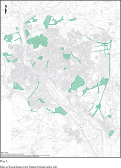
(ii) Sites of Local Interest for Nature Conservation (SLINCs) - these sites have nature conservation value at a local level within the City. Their importance is influenced by the proximity of residential or community facilities and their accessibility (actual or potential) to people. In other words their value is derived from a combination of, usually moderate, wildlife interest and the community value of the site. The City Council intend to publish further guidance containing details of the location, extent and nature conservation interest of the SLINCs. The SLINCs are shown on the Proposals Map but, for clarity, are also identified on Plan 5.
11.25 The identification and evolution of locations, features and species that are significant to biodiversity in Exeter is an ongoing process. A new survey of wildlife sites in Exeter has been carried out by the Devon Biodiversity Records Centre. This is likely to result in changes to SNCI and SLINC boundaries. These changes will be considered through the preparation of the Local Development Framework.
11.26 The site protection policies are subject to weighting. Since exceptions to the protection of sites of international or national importance for nature conservation are likely to be extremely rare in Exeter, there is no need to provide local plan guidance on such circumstances.
11.27 Locally important sites are normally accorded less weight but can be just as valuable, on the local scale, as a nationally important site is on the national scale. Within urban areas, local sites can take on an enhanced value due to the relative scarcity of wildlife sites and the fact that they are often close to large areas of population, community facilities and schools - thus there is the potential for the site to be well used and yield a larger ‘sum-total' of amenity/recreational/educational value than a similar site that is located away from a populated area. Where development is proposed that would affect a local site, it will be assessed against the particular nature conservation value of the site. Developers may be required to provide ecological survey information. If permission is granted it will be subject to conditions or planning obligations which seek to minimise the impact and ensure that effective mitigation and compensatory measures are carried out. Features of nature conservation importance can also be protected through the establishment of buffer zones.
11.28 Permitted development rights can be removed by the imposition, by the Secretary of State, of a direction under Article 4 of the Town and County Planning (General Permitted Development) Order 1995. This can be an important tool in the control of development that is potentially damaging to sites, particularly non statutory, of nature conservation value.
[Click to see larger image in a pop-up window]
Plan 5: Sites of Local Interest for Nature Conservation LS4
11.29 Certain species are specifically protected through a hierarchy of legislation. European Priority Species and European Protected Species are listed in the Conservation (Natural Habitats etc) Regulations 1994. This would for example, include bats and otters. The Wildlife and Countryside Act (as amended by the Countryside and Rights of Way Act 2000) gives various degrees of protection to certain animals and plants. The Protection of Badgers Act 1992 offers specific protection to badgers and their setts. All species that fall into the above categories are a material consideration. In addition, the City Council will treat materially the presence of any species that are listed on National/Regional/Local Biodiversity Action Plan lists. Applicants may be required to provide survey information. In view of the level of protection afforded through legislation there is no need for Local Plan policy guidance.
11.30 These are sites which are of scientific or educational value either because they contain finite or limited deposits or landforms that are irreplaceable if destroyed or, because they provide exposures of a deposit which are plentiful or extensive but underground. The designation of RIGS is one way of recognising and protecting important earth science and landscape features for future generations. The Proposals Map shows currently identified RIGS but it is likely that other RIGS will be identified.
11.31 Regulation 37 of the Habitats Regulations 1994, provides guidance on the protection and management of features of importance for nature conservation. The aim is to protect and manage such features that are present in the area and to protect nature conservation (wildlife) corridors, links and ‘stepping stones' between any features, and sites of nature conservation value, in order to prevent fragmentation of nature conservation sites.
11.32 Guidance on the features that may be relevant in a locality can be obtained from English Nature's Area Nature Conservation Profile. This includes active corridors, flood-plain, rivers, streams, their banks and flood plains, ancient trees, hedgerows and hedgerow trees, wetlands, canals and ponds, ditches, copses, reedbeds, ancient woodland, species rich grasslands, grazing marsh, seasonally flooded fields and urban habitats.
11.33 Appropriate management of these features will be encouraged generally, and particularly by the imposition of conditions on planning permissions, the use of planning obligations and by entering into management agreements with landowners and developers where appropriate.
11.34 Particular regard will be given to the protection of wildlife corridors through and around the City and linking areas within the City to the countryside beyond. Wildlife corridors act as routes for animals (mammals, birds, insects) and plants and may provide a valuable role in conserving wildlife in the City. They provide valuable ‘highways' to urban areas thus effectively ensuring that several small habitats become one large overall habitat. They may help prevent loss of specialisation and diversity associated with small isolated habitats. They form essential stepping-stones for the dispersal and mixing of genetic diversity.
11.35 Wildlife corridors are significant on different ‘scales' within the City. On a City-wide scale the River Exe and adjoining land either side connects the countryside on the north of Exeter with the marshes and estuary to the south, while sub-links along rivers, streams, their banks and floodplains and green spaces (in a herringbone fashion) allow wildlife to disperse throughout the City. At the other end of the scale a length of hedgerow might be particularly important in allowing wildlife to move from a piece of woodland to an area of residential gardens. Exeter also has several streams which dissect the City. These have existing value and have considerable scope for enhancement.
11.36 The value of wildlife corridors encompasses more than just the movement of wildlife. They can, and usually are, significant landscape and amenity features in their own right and contribute towards the greening of the City and the quality of life of residents and visitors.
11.37 If development is likely to cause damage or degradation to a habitat or feature of nature conservation importance, mitigation and compensation measures will be considered. These measures will be based on an assessment of the effect that the development will have on the beneficial attributes associated with the habitat or feature. For example, damage to a particular habitat could result in the loss of species and assemblages of ecological communities, loss of amenity value that these assemblages provide to visitors and the local community, loss of an important landscape feature or loss of flood prevention capacity if a wetland area is damaged.
11.38 Mitigation is concerned with minimising the damage if development were to be carried out. This might include avoiding development on certain parts of the site or protecting habitats or features by suitable fencing, bunding or any other measures such as buffer zones around water courses and wetlands. Compensation is concerned with replacing habitats or features where development will cause their loss. The assessment of any mitigation or compensation should be based upon the likely success of any measures being able to suitably protect or recreate the habitat in question. Where mitigation or compensation is required, measures should include long term funding for the management and enhancement of any retained or replacement habitat or features.
11.39 Existing valuable habitats and features, along with their attributes, will often have taken a very long time to develop. It may, in practice, be impossible to fully recreate habitats or features that are lost and/or it could take a considerable period of time for a replacement habitat to develop and attain the previous values that the habitat enjoyed. For example, if an area of ancient woodland were to be damaged or destroyed by development, then the mitigation for the loss of the ecological, amenity and landscape value could be attempted by creating a new woodland in another location but it would take many hundreds of years for the new woodland to attain the attributes that the old woodland enjoyed. In order to adequately compensate for the loss, the developer would be required to create a woodland which is considerably larger than the original woodland. This larger area would, more quickly, develop an equivalent amenity and landscape value and the larger size would assist in the development of biological diversity.
LS2: DEVELOPMENT THAT WOULD HARM THE INTEGRITY OF A RAMSAR SITE, SPECIAL PROTECTION AREA OR SPECIAL AREA OF CONSERVATION, OR WHICH CONFLICTS WITH THE CONSERVATION OBJECTIVES FOR SUCH A SITE, WILL NOT BE PERMITTED.
LS3: DEVELOPMENT THAT WOULD HARM THE WILDLIFE OR GEOLOGICAL INTEREST OF A SITE OF SPECIAL SCIENTIFIC INTEREST WILL NOT BE PERMITTED.
LS4: DEVELOPMENT THAT WOULD HARM A SITE OF NATURE CONSERVATION IMPORTANCE OR A SITE OF LOCAL INTEREST FOR NATURE CONSERVATION OR A REGIONALLY IMPORTANT GEOLOGICAL/GEOMORPHOLOGICAL SITE OR LANDSCAPE FEATURES WHICH ARE OF IMPORTANCE FOR WILD FAUNA OR FLORA, OR WILDLIFE CORRIDORS, WILL ONLY BE PERMITTED IF:
(a) THE NEED FOR THE DEVELOPMENT IS SUFFICIENT TO OUTWEIGH NATURE CONSERVATION CONSIDERATIONS; AND
(b) THE EXTENT OF ANY DAMAGING IMPACT IS KEPT TO A MINIMUM AND APPROPRIATE MITIGATION AND COMPENSATORY MEASURES ARE IMPLEMENTED.
^ Top | < Previous | Next >